An Interactive Map of West European Parties

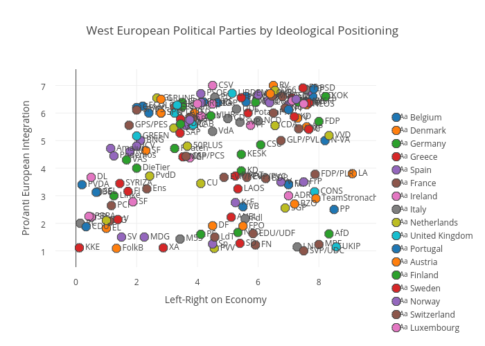
Following on the previous post on Southern Europe, this is a map of all West European parties mapped along their economic policy positioning and their position on European integration. By clicking here, you get access to a large interactive version of the map where you can show and hide countries and zoom in and out. As for the previous one, data is based on the latest round of the Chapel Hill Expert Survey.
West European Political Parties by Ideological Positioning

One response to “An Interactive Map of West European Parties”

Leave a Reply

Fill in your details below or click an icon to log in:

WordPress.com Logo

You are commenting using your WordPress.com account. Log Out /  Change )

Facebook photo

You are commenting using your Facebook account. Log Out /  Change )

Connecting to %s

%d bloggers like this: